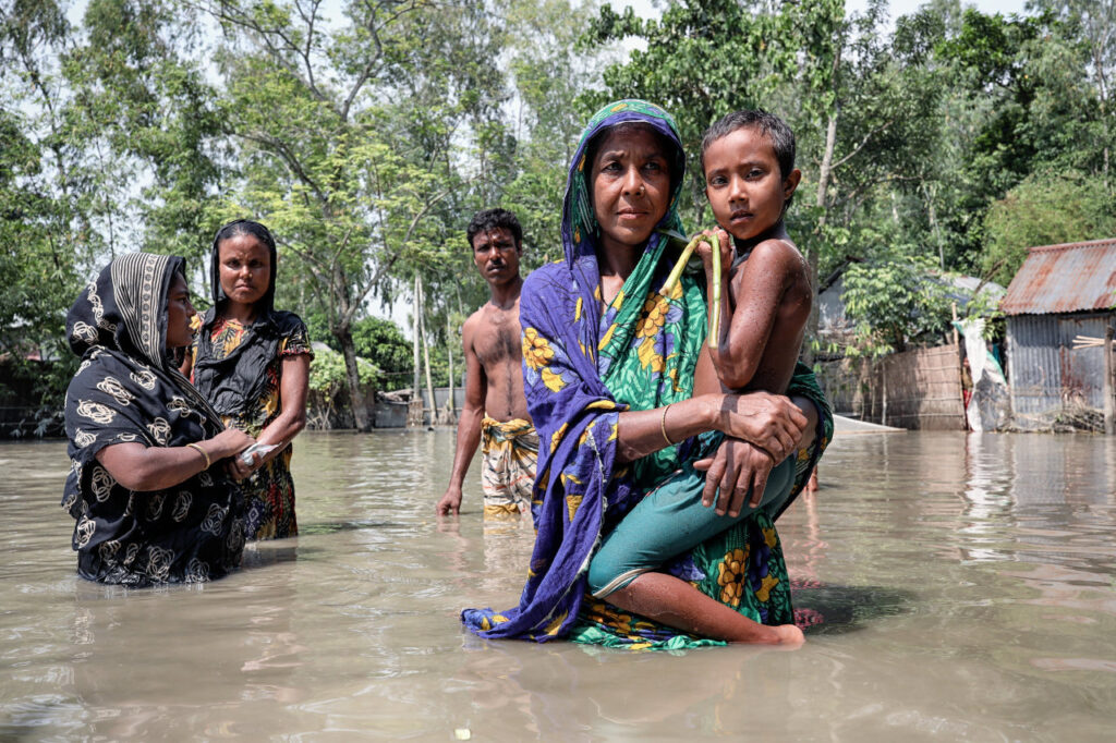
India has categorically dismissed the suggestion that the release of water from the Dumbur Dam on the Gumti River in Tripura is responsible for the recent flooding in Bangladesh. Pointing to the actual situation, India highlighted the role of extreme weather conditions, specifically unprecedented rainfall, and stressed the importance of continued collaboration between the two nations to mitigate the impacts of such natural disasters.
In an official statement, the Ministry of External Affairs (MEA) of India described the allegations as “factually incorrect,” emphasizing that the severe flooding in Bangladesh is primarily a consequence of the intense rainfall in the region. The MEA responded to reports circulating in Bangladesh by stating, “We have noticed concerns in Bangladesh about the floods in eastern border districts being attributed to the release of water from the Dumbur dam upstream of the Gumti river. This is factually incorrect.”
The Ministry further clarified that the Dumbur Dam, situated over 120 kilometres upstream from the Bangladesh border, is a low-height structure designed primarily for power generation. Its operational parameters, as underscored by the MEA, do not have the capacity to cause downstream flooding on the scale witnessed recently.
In response to the bizarre reactions within Bangladesh, where social media platforms and “student protestors” have taken to the streets, chanting slogans against India, the Indian establishment in New Delhi deemed it necessary to underscore the importance of basing cross-border environmental discussions on facts. The statement reaffirmed India’s commitment to maintaining strong bilateral relations with Bangladesh, particularly in the management of shared water resources.
Heavy Rainfall Identified as the Main Cause
The MEA pointed out that the catchment areas of the Gumti River, which flows through both India and Bangladesh, have experienced the heaviest rains of this year over the last few days. This natural phenomenon has led to a significant rise in water levels downstream, which has contributed to the flooding.
“The flood in Bangladesh is primarily due to waters from these large catchments downstream of the dam,” the MEA noted, stressing that the flooding is a result of natural climatic conditions rather than any human intervention from the dam’s operations.
The Dumbur Dam, located more than 120 kilometres upstream from the Bangladesh border, is a low-height structure, approximately 30 metres tall, which generates power feeding into a grid. Bangladesh draws about 40 MW of power from Tripura as part of this arrangement. Along the approximately 120-kilometre river course, there are three water level observation sites at Amarpur, Sonamura, and Sonamura 2.
Since 21 August, heavy rainfall has been persistent across Tripura and the adjacent districts of Bangladesh. In such situations, automatic water releases from the dam have been observed. The Amarpur station, which is part of a bilateral protocol, has been transmitting real-time flood data to Bangladesh. The MEA stated that data showing a rising trend was shared with Bangladesh until 1500 hours on 21 August 2024. However, due to flooding, a power outage at 1800 hours caused communication issues. “Despite this, we have endeavoured to maintain communication through other means created for the urgent transmission of data,” the statement added.
The MEA highlighted that floods on the common rivers between India and Bangladesh are a shared challenge, causing suffering on both sides. Resolving these issues requires close mutual cooperation. India and Bangladesh, which share 54 common cross-border rivers, view river water cooperation as a vital component of their bilateral engagement. India reiterated its commitment to resolving issues and addressing mutual concerns in water resources and river water management through bilateral consultations and technical discussions.
India has maintained transparency in its water management practices by operating several water-level observation sites along the Gumti River, including those at Amarpur and Sonamura. These sites provide real-time data, which is shared with Bangladesh as part of a bilateral protocol. Through consistent and transparent practices, India underscores the importance of cooperation in managing shared natural resources and addressing the challenges posed by natural disasters like flooding.


